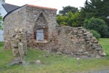
Boucle de Croazac
Crossac
Destination
Boucle de Croazac
44160
CROSSAC
GPS coordinates
Latitude : 47.41209
Longitude : -2.16760
Itinerary Info
- Type of Excursion :
- Items/Points of Interest :
- Briere marshland
- Period :
- An Half-day
- Practical information :
- Town of departure Crossac
- Length in km 15.5 km
- Average duration 4h00
General information
- Useful Information :
- Section subject to flooding on the circuit/route de novembre Ă Â mai
- Ideal time to practice de juin Ă Â octobre
- (Geographical) Location from Point of Departure :
- Distance from the railway station 7 km (Pontchâteau)
- Distance from the shops 200 m (Crossac)
- Distance from a bus stop 0 km - LILA - T5 - ArrĂŞt : Plaisance
- The Regional Natural Park of la Brière
Accessibility
- Disabled Access :
- Not accessible for people with reduced mobility